Paddling the Gulf Coast: 7 ‘Blueways’ to Explore on the Mississippi Gulf Coast
OutdoorHub Reporters 06.29.18
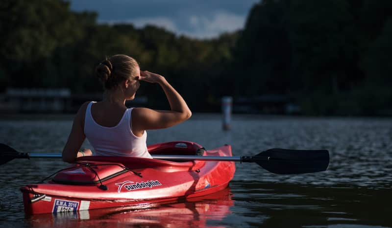
If you’re headed to Mississippi’s Gulf Coast, don’t forget to pack a kayak or canoe. (Or you can rent one while you’re there!)
Why? The three counties on the Mississippi Gulf Coast home to some of the country’s most scenic protected waterways. This is a natural playground for paddlers.
What’s even better, Mississippi has designated a number of its rivers, streams, marshes and bayous as “blueways.” Blueways are essentially mapped water trails, just like hiking trails, that traverse the state’s most beautiful waterways. With itineraries for paddlers of all experience levels, a blueway trip offers the chance to experience stunning landscapes, birds and wildlife up close and personal. Not to mention, a float trip in Mississippi is lots of fun!
From multi-day trips, to lazy afternoon paddles, each trail offers a one-of-a-kind experience, with plenty of history, beautiful nature, and relaxing waters to paddle and explore.
Which Blueway Should You Explore?
There are tons of great blueways along Mississippi’s Gulf Coast and in the inland Gulf counties. Here are a few of our favorites:
Bayou Bogue Homa
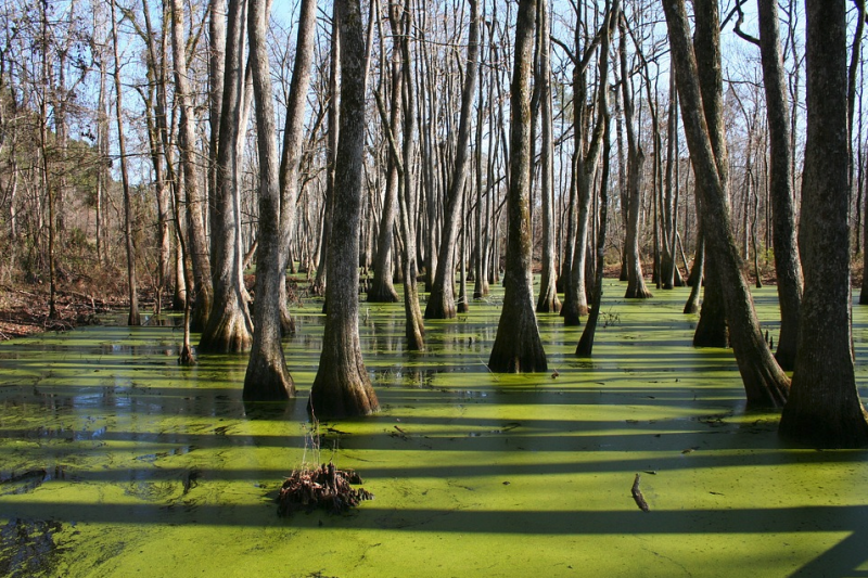
Located on the Mississippi-Louisiana border, the Bogue Homa Bayou provides a journey past incredible cultural and historic sites. The ghost towns of Logtown and Possum Walk, for example, lie on the bayou’s shores. And thanks to helpful interpretive markers, you can explore history while you paddle.
This stretch of water is perfect for a relaxing afternoon float trip. At just about 2.5 miles round-trip, Bogue Homa features meandering waters that flow through bald cypress forests and dense vegetation. Bogue Homa is also home to numerous critters, including ospreys, hawks, kingfishers, and even alligators, so keep your eyes peeled!
- Routes: Start from the East Pearl Boat Launch, north of Pearlington, MS. There are two drop-in points at the trailhead. The bayou flows east and forks into two turnarounds: the .5-mile Southeast Turnaround and the .7-mile Northeast Turnaround.
- Duration: The trail is a roughly 2.5-mile out-and-back and takes about 2.5 hours to complete.
Red Creek Blueway
Red Creek offers visitors a relaxing water retreat, with meandering red-hued waters (which is caused by naturally-occurring tannins) and tons of white sandbars for picnics, camping and relaxing.
The blueway is a 30-mile stretch, and there are four segments for paddlers, each offering beginner rapids and winding streams to traverse. The first portion is known as the Clay Shelves segment, and it features vibrant red clay shelves along the banks with a series of smaller rapids. Running from Highway 26 to Highway 49, the Clay Shelves portion is the longest segment, running just under 10 miles.
Other segments include the 6.2-mile Railroad Trestle, the 4.4-mile Natural Springs segment, and the 9.6-mile Red Bluff segment.
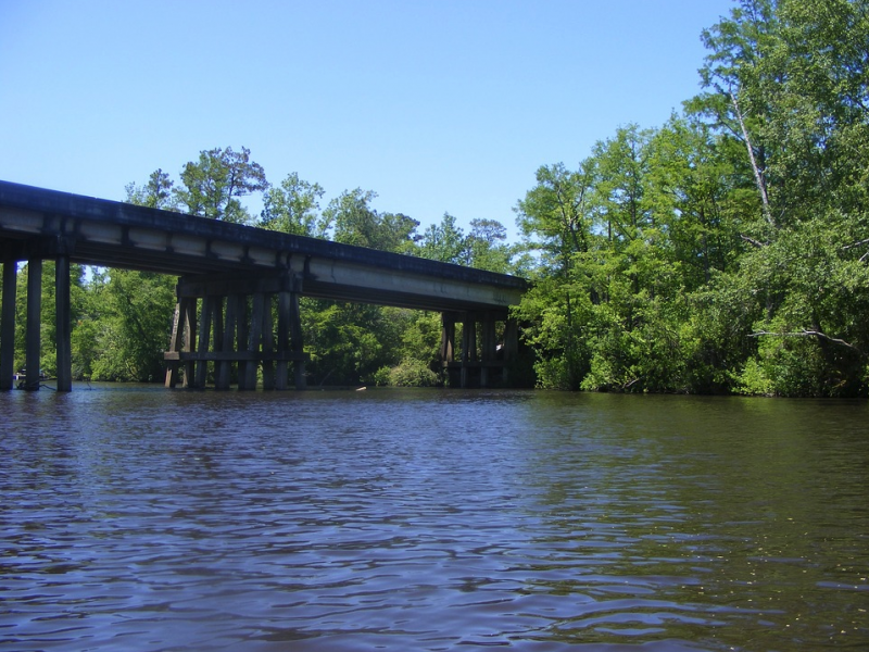
There is plenty to explore on Red Creek. The waterway is home to numerous historic bridges, including City Bridge, and gorgeous old railroad trestles, with plenty of places to pull out for lunch or to go for a swim.
- Routes: The Natural Springs segment is a favorite because it passes through De Soto National Forest and by the site of the historic Ramsey Springs Hotel. If you’d like more of a challenge, the Clay Shelves and Red Bluff segments are each about 10 miles in total.
- Durations: Floating the full length is a 22-hour trip. The Red Bluff and Clay Shelves segments take about 7 hours each, while the shorter Springs segment is just a three-hour trip and the Railroad Trestle segment is a five-hour trip. If you plan to paddle the entire duration or even one of the longer segments, there are areas for rustic camping along the water or you can rent a cabin, as several are available as vacation rentals at various locations.
Jourdan River Blueway
The Jourdan River is an 8.5-mile trail that runs through central Hancock County. Flowing from Bayou Bacon to Bayou Talla, the river offers a quiet, relaxing float, with plenty to see and do.
There are two launching points for the river, the McLeod Boat Launch at Mile Marker 5, as well as the Bayou Talla launch. That means paddlers can make their own adventures on the stunning Jourdan. A popular route is to take the McLeod and travel upriver to Bayou Bacon. This route takes paddlers on a winding trip that passes oxbow lakes. These natural lakes were actually once part of the river, but became detached as the river changed course.
Other sights like the numerous sand bars (great for sunbathing and picnicking), as well as the 1.5-mile hiking trail at McLeod Water Park, offer great chances to pull out and explore the hardwood forests.
Downriver, around Bayou Talla, the Jourdan winds past cottages in the Jourdan Shores development and passes artesian springs, which bubble in the river. This is a shorter float, but it’s still tons of fun!
- Routes: There are two popular routes: From McLeod to Bayou Bacon (5 miles) and from Bayou Talla to McLeod (3.5 miles).
- Duration: A one-way trip from Bayou Talla to Bayou Bacon takes 5 hours.
Wolf River Blueway
Wolf River takes its name from the red wolves that populated the area for hundreds of years. These days, the red wolves have moved on, but the river still flows, offering a relaxing summertime playground for visitors.
The Wolf River blueway is a favorite spot for paddlers, due to its long, meandering route north of Bay St. Louis. The river also offers a few unique trips: A short, 5-mile loop that takes you into the bay and up to the mouth of the Wolf River, as well as a longer, 15-mile, all-day excursion.
While you’re paddling Wolf River, you’ll enjoy beautiful natural sights and sounds. Ancient oak trees dot the Little Bay Loop trail, and paddlers are regularly treated to a symphony of shore birds. The longer, 15-mile route is best for experienced kayakers and canoers, due to the demands of its length and its swifter currents.
- Routes: The Little Bay Loop is a relaxing 5-mile loop that starts at Necaise Public Boat Launch. The Wolf River Canoe Trail runs 15.2 miles from Cemetery Landing to Tucker Road; private shuttle service is available between the launch and pull-out points.
- Duration: The Little Bay Loop takes just a few hours, but paddlers can spend some extra time exploring side routes. The longer route takes 8 to 9 hours.
Turkey Creek Blueway
Turkey Creek Blueway runs through the central part of Harrison County, winding its way to Bayou Bernard. A popular destination for fishing, swimming and canoeing, the river has long played an important role in the surrounding communities.
The blueway shares its name with the town of Turkey Creek, a historic African American community that was founded just after the Civil War. Along the trail, you’ll find numerous historical sites and markers – great for short breaks and learning the lay of the land.
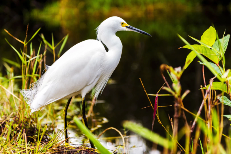
This stretch of creek is also a favorite spot for birding. Brown and white pelican, osprey and heron populate the lower reaches near the protected Bayou Bernard, while the upper reaches take you through wooded riparian areas, under beautiful old bridges and past historic sites.
- Routes: Start your trip at the Gulfport Lake Boat launch. The trail is an out-and-back and runs about 5 miles round-trip.
- Duration: The complete trail takes about three hours.
Pascagoula River Blueway
The Pascagoula River is the longest free-flowing river in the U.S., and is one of the most popular destinations in the state, offering paddlers running rapids and meandering backwaters. If you’re interested in a multi-day trip, plan a float on the Pascagoula.
There are two blueways on the river: One in George County, a 23-mile stretch that includes camping, fishing, hiking (and of course, great paddling). The George County stretch is surrounded by nearly 50,000 acres of protected habitat, which gives this blueway a distinctly untamed and wild feel.
The other blueway on the Pascagoula is in Jackson County, which wanders 10 miles from Bennet Bayou to the marshes outside of Pascagoula. The lower portion of the river offers plenty to see and do. Bird-watching is big here! In fact, two-thirds of Eastern migratory birds pass through these protected waters. Plus, there are numerous parks, piers and rest stops along the way.
- Routes: The Jackson County portion has two routes: A 10-mile one-way trip, as well as a 12-mile trip (which follows the same route but includes a loop at Moss Point). In George County, there are six boat launches. Most trips start in Merrill, to the north, and can travel all 23 miles downriver to Josephine Sandbar (one of the largest in the state).
- Duration: A trip on the Jackson County Pascagoula route takes about 7 hours, while a 23-mile round-trip in George County takes roughly 16 hours (it’s best as a two- or three-day trip).
Old Fort Bayou Blueway
Located in the waters north of Ocean Springs, Old Fort Bayou winds and meanders through Jackson County. Along the way, you’ll be treated to some of Mississippi’s finest protected landscapes. The river passes through Twelve Oaks Conservation Park, the Sandhill Crane Wildlife Refuge and the Old Fort Bayou Coastal Preserve.
This is the blueway for nature lovers. Thanks to its resident gulls, cranes and herons, birdwatchers spend a lot of time here. Old Fort Bayou is popular among fishermen, with bass and red fish being the most commonly caught species.
- Routes: Old Fort Bayou runs for 13 miles, from just north of Ocean Springs to the Sandhill Crane refuge. A popular trip starts in Gulf Hills and ends 9 miles upstream at the Interstate 10 boat launch.
- Duration: A one-way trip takes about 6 hours; the Gulf Hills to Interstate 10 route takes about 4.5.
Choose Your Own Adventure on Mississippi’s Blueway Trails
These seven trails offer the best of the best in coastal floating. You’ll while away an afternoon, and the itinerary is up to you. Stop for a swim, pull out for a hike, visit a cultural landmark, or bring your fishing pole and throw some lines.
In short, a blueway excursion is one of the best ways to spend a day on on the Mississippi Gulf Coast.

Plan your Mississippi Gulf Coast vacation today! Visit GulfCoast.org to explore all there is to see, experience and eat along 62 miles of scenic shoreline.

