Oregon DFW Maps Point to Southwest Oregon Fishing Locales
OutdoorHub 09.12.12
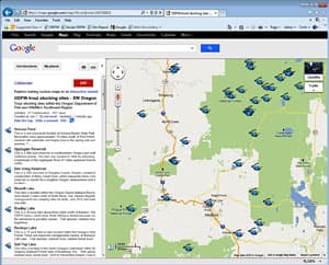
The Oregon Department of Fish and Wildlife today introduced two new interactive fishing maps to help anglers find fishing locations in the agency’s Southwest Region.
The Google-based maps detail 53 trout stocking sites around the Rogue, Umpqua and South Coast areas of Oregon as well as 50 places to go fishing within 60 minutes of Medford. ODFW’s Southwest Region covers Douglas, Coos, Curry, Jackson and Josephine counties.
The fishing maps can be accessed from ODFW’s website from links in several places, including the Trout Stocking Schedule page, weekly Recreation Report and Where and How to Fish page. The maps allow viewers to zoom in for a close-up at the sites in their choice of map, satellite and terrain view. Clicking on the icon opens a text balloon with site photos, links to nearby campgrounds and other points of interest, fish species, and links to ODFW’s weekly recreation report, trout stocking schedule and sport fishing regulations. Users are also capable of generating GPS coordinates and turn-by-turn directions to each site from any starting point.
Trout fishing is the most popular fishery in the state, according to a 2006 ODFW survey of anglers. Of those anglers surveyed, 73 percent said they had fished for trout in the past year. That equates to approximately 420,000 anglers.
“There is intense interest in trout fishing in Oregon,” said Scott Patterson, ODFW fish propagation program manager. “However, just knowing where to go fishing can be a barrier to enjoying a day at the lake. We hope these tools inspire people to get out and do some trout fishing.”
The Southwest Region map is the second regional Google-based fishing map that ODFW has released this year. The agency launched a similar trout fishing map for itsNorthwest Region last April. The 50 Places to Fish within 60 Minutes of Medford is the second map of this kind. ODFW produced a similar map for the Portland area in 2010. The “50 in 60” maps are designed to help people fit fishing into their busy schedules by showing there are many fishing venues just a short distance from home.
A 2009 study for the agency by Dean Runyan and Associates estimated that the freshwater fishing contributed nearly $200 million to the state’s economy. While the study didn’t break sales down by fresh water species, which would also include salmon, steelhead and other types of fish, the economic impact of trout fishing on the state’s economy is nonetheless significant. The $4 million annual cost of the trout stocking program is covered primarily through the sale of Oregon fishing licenses.
“Trout fishing is a huge economic engine for Oregon,” said Patterson. “It also adds significantly to our quality of life.”
The fishing map is the latest addition to a suite of Google-based maps, including the Wildlife Viewing Map and Oregon Hunting Map.
For more information, visit ODFW’s website at www.dfw.state.or.us.

