Google Unveils “Street-view” for Australia’s Great Barrier Reef
OutdoorHub Reporters 09.26.12
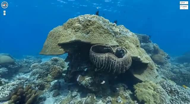
If you’ve visited the Google homepage today, you may have noticed a small message below the search field that says, “Explore the Great Barrier Reef with Google Maps. Scuba gear optional.” Indeed, when Google set out to map the whole world, I didn’t think they meant THE WHOLE WORLD!
The company’s newest available street-view feature takes you underwater to explore the Australia’s Great Barrier Reef, something only attainable by Australian locals or visitors with lots of money and a scuba-diving license.
The Google Maps images of the largest coral reef system in the world show sea turtles swimming with a school of fish, manta rays, sunset views as well as a chance to digitally walk around on the beach nearest to the reef. Explore it all yourself at www.maps.google.com.
httpv://youtu.be/7syWPIZt9B4

