Snowmobile Trail System Introduces New Interactive Map for South Dakota
OutdoorHub 12.13.12

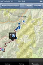
Trail conditions and routes will be easier than ever for snowmobilers to view thanks to a new interactive trail map.
In addition to trail conditions, the interactive map pinpoints businesses, restrooms and parking areas along the state snowmobile trail system.
“By clicking on the trails, snowmobilers can view current trail conditions, and eventually pictures,” said state snowmobile trail coordinator, Tony Schmitt. “The best part is, the map can be downloaded to your smart phone.”
The trail map works with the GPS technology in smart phones to show snowmobilers their location on the trail.
Snowmobile Trails in the Black Hills are scheduled to open Saturday, Dec. 15, but trail officials are waiting for snow.
“The Black Hills has seen minimal snowfall so far,” said Black Hills Trail supervisor, Shannon Percy. “Grooming operations will be on hold until we see additional accumulations.”
Trails in eastern South Dakota opened Dec. 1, and while there was significant snow over the weekend, bare spots remain on the trails.
“Even though several inches of snow fell in some areas in Eastern South Dakota, the high winds left many areas along the trail system without snow, and the majority of the eastern trails have not been groomed,” said Schmitt.
The interactive trail map is available on the Game, Fish and Parks’ website (http://gfp.sd.gov/to-do/snowmobile/map.aspx) as well as on the SDGFP Outdoors mobile app for Android and Apple devices.
Trail condition updates are also posted to Twitter accounts dedicated to both the Black Hills and the East River trails (www.twitter.com/SDsnowBHills and www.twitter.com/SDsnowEast).
For more information about snowmobiling in South Dakota, visit www.gfp.sd.gov, or call 605-584-3896 for Black Hills trails information, or 605-773-3391 for East River trails.

