Hydrogeomorphic Restoration and Conservation Partnerships Build Future for the Big Muddy
OutdoorHub 12.17.12
Cutting edge research funded by Landscape Conservation Cooperatives in the Midwest, coupled with on-the-ground conservation and management through public-private partnerships, is building a future for the lower Missouri River.
The Plains and Prairie Potholes LCC and Eastern Tallgrass Prairie and Big Rivers LCC, charged with identifying priority science needs to combat landscape scale natural resources threats, joined forces this year to support the Lower Missouri River Hydro-geomorphic Restoration and Management Project. This project will inform more effective conservation and management across 670 miles of the Missouri River from Decatur, Nebraska to St. Louis, Missouri.
The lower Missouri River, the largest free-flowing river reach in the United States, encompasses nearly 1.5 million acres of bottomland habitat for fish, wildlife and plants, while providing commercial transportation and recreation opportunities. Since European settlement, the Missouri River has been highly altered due to upstream reservoirs, water control and flooding events.
“We are gathering the data in layers, piecing together the geology, soil structure, topography, and finally, the hydrology of the river. What was the nature of the river before it was altered, including its dynamics, and seasonal and long-term patterns?” said Mickey Heitmeyer, lead researcher for the LCC project. “Once we have that data, we map it, layer over layer, and compare it to current day conditions.”
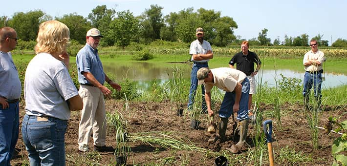
On-the-ground private landowners and natural resource managers, like those representing the U.S. Fish and Wildlife Service’s Partners for Fish and Wildlife Program and Missouri River Recovery Program, national wildlife refuges, state parks, and many others, will be able to use the data generated by this research to inform strategic land acquisition, land protection and restoration.
“For landowners who participate in the Partners for Fish and Wildlife Program, we try to explain that we are trying to restore historic habitats which have been lost to benefit migratory birds and resident wildlife,” said Kelly Srigley-Werner, program coordinator in Missouri. “The hydrogeomorphic restoration project will really help us target strategic areas to get back what used to be on the landscape and will be a powerful tool we can use to effectively demonstrate and communicate with landowners.”
The lower Missouri River contains countless conservation properties and efforts maintained by local, state and federal agencies, nonprofit groups and private entities. National wildlife refuges, state parks, conservation areas and other publicly owned properties can use the maps that are developed through the hydro-geomorphic analysis to guide land acquisitions, and restoration efforts in the face of evolving natural resources challenges like climate change, energy development and shifts in agricultural practices.
This year the Missouri/Mississippi Rivers Confluence Conservation Partnership – a Partners for Fish and Wildlife collaboration- was recognized by the Department of the Interior as a signature demonstration of partnering for America’s Great Outdoors Rivers Initiative, bringing together private landowners, conservation organizations, and public natural resources agencies to promote a balance between fish and wildlife habitat and agriculture and community development. The hydro-geomorphic analysis can also assist with guiding future efforts recognized and supported by America’s Great Outdoors.
Since 2004, the Missouri/Mississippi Rivers Confluence Conservation Partnership has restored and enhanced more than 21,000 acres of private land, and protected more than 8,000 acres of wetland habitat on private land across Pike, Lincoln, St. Charles and St. Louis counties.
“Our property has great interest in habitat conservation for waterfowl and other wildlife. We have been fortunate to have a trusting relationship with Ducks Unlimited, the U.S. Fish and Wildlife Service and other partners to help design and improve our lands through the Partners for Fish and Wildlife Program,” said private landowner Warren Hager. “The support this partnership provides has enabled our habitats to be more diverse, and our relationships have allowed us to rely on expertise when we need it.”
Leaning on the results of this cutting edge LCC research will improve scientific understanding about the lower Missouri River and provide a tool for the conservation community to put the right conservation efforts in the right places, for the right reasons, ultimately allowing for maximum return on conservation investments.

