Software Uses Complex Algorithms to Boost Fishing Success
OutdoorHub Reporters 10.24.13
A fishing trip in unfamiliar territory, uncooperative wind, and a small amount of bites would leave most anglers in a bad mood. For Brian Haymar, Dan Reed, and Ryan Rist, however, a frustrating trip set the groundwork of a new start-up company motivated to provide better and smarter fishing. The three anglers founded Strategic Fishing Systems LLC in 2007. The premise was simple: use math and science to predict the best fishing grounds.
“After that trip, we said there’s got to be a better way to find where the fish are,” Rist told the Associated Press.
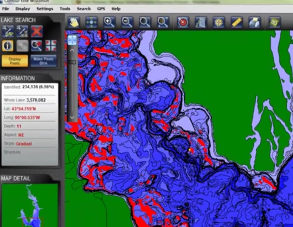
So they partnered with LakeMaster to create the Contour Elite, a software suite that takes in data such as weather, temprature, lake terrian, water currents, vegetation, fish species, fish behavior, and other data to predict where the bite will be the heaviest.
“Fish are not spread out evenly in a lake. You know this. You’ve spent days and sometimes years trying to find the best fishing spots. Fish are grouped together in certain areas with specific characteristics. The layout of the lake bottom, the depth, the type of bottom structure, the exposure to sunlight, water currents, available cover such as vegetation, stumps or cribs, and bottom substrate such as rocks or sand are all determining factors,” says the company’s website.
The software crunches all the data points into an easy-to-understand map that predicts a targeted species’ location. Contour Elite’s designers hope that it will make planning for a trip much easier.
“Our science side has built these algorithms based on the species of fish,” Rist said. “We know that walleye for example prefer deep water and they will move into more shallow water at night. So, looking for walleye in the evening in the summer is going to be a lot different formula than looking for bass in the spring.”
Contour Elite can also transfer data to chartplotters and fish-finders for easy navigation while on the water. Using data from LakeMaster, the company was able to map out more than 1,000 lakes in 20 states across the central United States.
An early overview video can be seen below:

