5 Must-have Apps for Hunters
Bernie Barringer 08.18.15
If you have a smartphone or tablet you probably already have a number of deer hunting apps that you use in your endeavors: weather apps, Google Earth, basic free mapping aids, and so on. Some of them are helpful but like most things, you get what you pay for—they can be very rudimentary. For hunters, there are great apps that do more than you probably knew about. Here are five deer hunting apps that are specifically designed to do things hunters need done, and do them well.
1. ScoutLook Weather
There are hundreds of weather apps, but this one stands above the rest in its applications for hunters. In addition to detailed weather forecasts and accurate radar, ScoutLook Weather shows your position on a map, and if you like, it will show your scent cone based on current wind speed and direction. Waterfowl hunters can utilize the “Set Zone” feature, which shows how to set decoys based on current wind direction.
The “Deer Log” merges weather, wind mapping, solunar times, tides, hourly barometric changes, and logbook features into one app. Deer Log automatically captures time, date, GPS location, weather details, and wind and moon info at time of sighting and enables real-time deer logging in drop downs with no typing. You can review logs on phone or PC since the data syncs with your account, regardless of the device you’re using.
2. Trimble Outdoors GPS
The Trimble Outdoors app basically turns your phone into a GPS, which many apps can do, but this one has the additional ability to show topographic maps, forest roads, hunting unit boundaries, and public lands. It also has weather and a trip planner feature that allows you to mark out routes and measure them. You can mark your camp, the location of downed game, fresh water, or a barrier/hazard. If you like you can print off your maps after you create them.
The basic app is free but there are costs for the add-ons which are available in bundles or individually. There is a $30 annual membership.
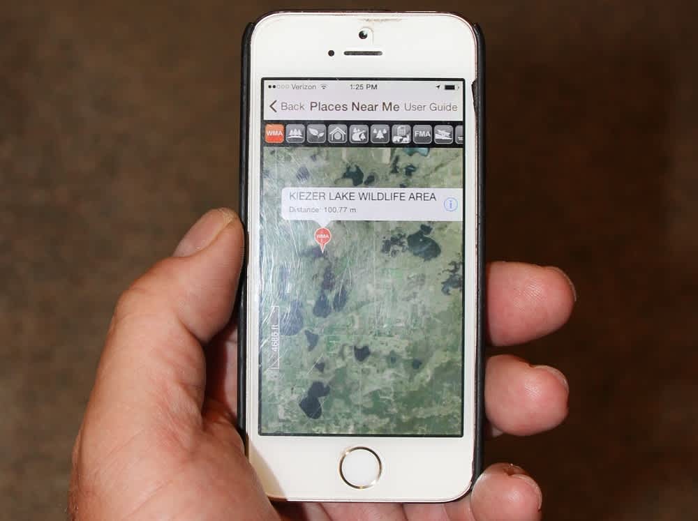
3. Mapping and Property Lines onXmaps
A remarkable product for the hunter on the go is the onXmaps Hunt app. This app requires a much greater investment than other options, but when you need it, you will not regret the money you spent on it. You can download the maps or buy a separate chip which costs about $100, plus there is a $29.99 per state annual fee.
This app offers maps on your phone with property owners listed, plus names and at times contact information for the landowners. In many areas where land is broken up into a checkerboard of private and public land, this tool can be invaluable for finding out where you are, and if you are looking across a fence, it will tell you who owns the land on the other side of the fence. See a buck, a bull elk, or an antelope over there? Give the landowner a call for permission to go after it.
When cell phone coverage is poor, just put the phone in airplane mode and use the phone’s GPS to determine your location. The maps can be downloaded ahead of time so they are on your phone whether you have cell phone signal or not.
4. PointHunter
PointHunter keeps track of your hunting tags, applications, and drawings, and tells you how many preference points or bonus points you have for various species in most states. You can set it to remind you of drawing dates, application dates for points and tags, and season dates. The app automatically sends you an email at the first of each year with a point summary for the states and species for which you have applied in the past. You can also set it up to send you an email or text on the opening day of each application period and two days before the end of the application period.
5. Pocket Ranger
The Pocket Ranger apps are useful tools for finding public hunting land and viewing the opportunities that are available on each parcel. It shows aerial photos with pins at public hunting areas. Tap the pin to be taken to more information about the area including game species available, management, special regulations, contact information, and maps of the area’s boundaries. You can download the maps while on WiFi, then cache them to your phone so you do not have to use data each time you want to view them.
The app also includes state and federal parks. Several states are available with more being added.
All of these deer hunting apps are available for iOS or Android so you can use them on your smartphone or tablet. You can choose the portability and convenience of a smartphone or the larger screen and better visibility of a tablet.
Follow Bernie’s bowhunting adventures on his blog, bowhuntingroad.com.
Note added 11:28 a.m. 8-18-2015: This article has been updated to include corrected price information about onXmaps’ Hunt app.

